Trail Walking La Roquebrussanne - SityTrail - 2718180 - baume-fere-font-coulette-croix-de-berard - Photo

SityTrail - 2718180 - baume-fere-font-coulette-croix-de-berard

 affinetataille
affinetataille

User GUIDE

© OpenStreetMap contributors
Length
Length
14.4 km
Max alt
Max alt
752 m
Uphill gradient
Uphill gradient
538 m
Km-Effort
Km-Effort  
22 km
Min alt
Min alt
351 m
Downhill gradient
Downhill gradient
538 m
Boucle
Boucle
Yes
Creation date :
2021-05-20 22:18:25.279
Updated on :
2021-10-07 19:18:08.582

(0 Reviews)

Walking
Walking
6h00
Difficulty : Medium

Scan this QR Code to open this trail in the SityTrail application

FREE GPS app for hiking

Logo SityTrail SityTrail

IGN / Geographical institutes

Download SityTrail from the App Store Download SityTrail from Google Play

Logo SityTrail SityTrail World

The world is yours!

Download SityTrail from the App Store Download SityTrail from Google Play Download SityTrail on Huawei AppGallery

About

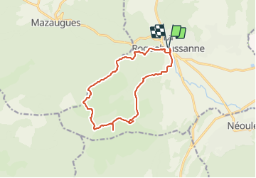
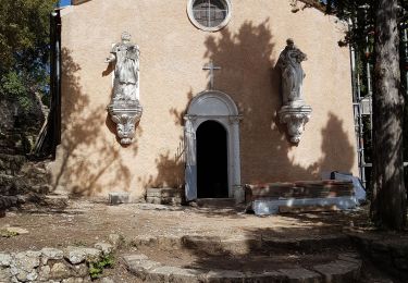
Trail Walking of 14.4 km to be discovered at Provence-Alpes-Côte d'Azur, Var, La Roquebrussanne. This trail is proposed by affinetataille.

Description

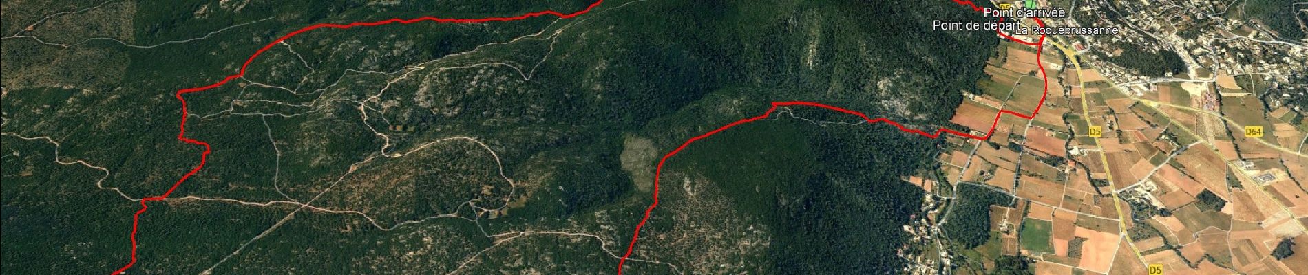
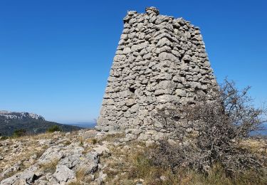
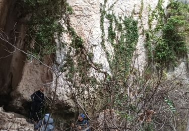
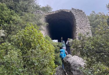
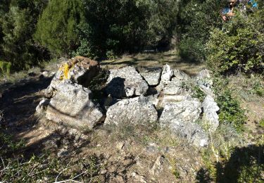
joli circuit qui passe par la grotte de baume fère  et la croix de Bérard à la fin du parcours sur le plateau d'Agnis.
Après avoir quitté la grotte, faire bien attention au tracé de la côte 623 à la côte 679, le sentier est perdu mais le cheminement est facile
Ne pas se diriger vers le Mas Fa réna , passage interdit.
Du Km 17,5à la croix de Bérard, bien suivre également le tracé le chemin qui est assez " discret ". Je vous souhaite une belle journée

Elevation profile

Photos

31 photos in total. Please click on a photo to see them all in the gallery.

Positioning

Country:
France
Region :
Provence-Alpes-Côte d'Azur
Department/Province :
Var
Municipality :
La Roquebrussanne
Location:
Unknown
Start:(UTM)
741275 ; 4802675 (31T) N.

Trails nearby

Trail Walking Mazaugues - le Mourre d'Agnis au départ du Caucadis - Photo
Walking
GUIDE
amiral13

Walking

Difficult
Mazaugues, Provence-Alpes-Côte d'Azur, Var, France
17.6 km | 27 km-effort
7h 8min
Yes
Trail Walking Mazaugues - Mazaugues le vallon de l'Herbette - Photo
Walking
martinemarie

Walking

Medium
(2)
Mazaugues, Provence-Alpes-Côte d'Azur, Var, France
12.2 km | 18.8 km-effort
7h 27min
Yes
Trail Walking La Roquebrussanne - la montagne de la Loube - Photo
Walking
GUIDE
amiral13

Walking

Medium
La Roquebrussanne, Provence-Alpes-Côte d'Azur, Var, France
13.5 km | 21 km-effort
5h 30min
Yes
Trail Walking La Roquebrussanne - La Roquebrussane-Jas du murier - Photo
Walking
francisdean

Walking

Medium
(1)
La Roquebrussanne, Provence-Alpes-Côte d'Azur, Var, France
18.4 km | 25 km-effort
5h 21min
Yes
Trail Walking La Roquebrussanne - La Loube 28-02-2024 - Photo
Walking
Christiancordin

Walking

Medium
La Roquebrussanne, Provence-Alpes-Côte d'Azur, Var, France
18 km | 27 km-effort
7h 58min
Yes
Trail Walking La Roquebrussanne - Jas d'Agnis au départ de la Roquebrussanne par le vallon de Valescure - Photo
Walking
FSantoni

Walking

Very difficult
La Roquebrussanne, Provence-Alpes-Côte d'Azur, Var, France
14.1 km | 19.3 km-effort
4h 23min
Yes
Trail Walking La Roquebrussanne - La Roquebrussane trace réelle - Photo
Walking
jouans

Walking

Very difficult
La Roquebrussanne, Provence-Alpes-Côte d'Azur, Var, France
19.9 km | 32 km-effort
7h 12min
Yes
Trail Walking La Roquebrussanne - La Roquebrussanne dec 2023 - Photo
Walking
ETMU5496

Walking

Difficult
La Roquebrussanne, Provence-Alpes-Côte d'Azur, Var, France
19.2 km | 31 km-effort
7h 0min
Yes
Trail Walking La Roquebrussanne - chapelle St André et grotte des irris - Photo
Walking
famillerudent

Walking

Difficult
La Roquebrussanne, Provence-Alpes-Côte d'Azur, Var, France
8.7 km | 13.3 km-effort
3h 1min
Yes


Close
My subscriptions